With a release of the records of over 35,000 individuals by TheGenealogist, family historians will now have the ability to discover valuable particulars about ancestors’ homes from the following parts of London in 1910: Cowley, Cranford (Bedfont), Great Stanmore, Harefield, Harlington, Harmondsworth, Harrow, Harrow Weald Hayes, Hillingdon East, Hillingdon West, Ickenham, Little Stanmore, Pinner, Ruislip, Uxbridge, West Drayton, Yiewsley and Wealdstone.
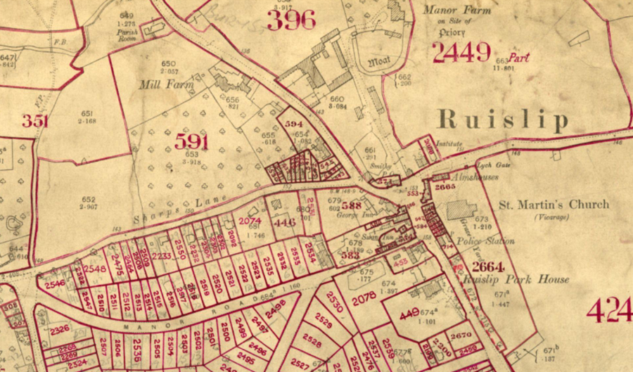
These latest residential records have been linked to detailed OS maps which allows the researcher to pinpoint an ancestors’ property on maps that go down to plot level. These land tax records were originally collected by the Inland Revenue’s Valuation Office and are sourced from The National Archives IR58 records. Searchable by name or keywords using TheGenealogist’s Master Search, or by selecting a pin from the map displayed inside the powerful Map Explorer™, this tool allows family historians the ability to switch between georeferenced modern and historic maps and so to gain a better understanding of the neighbourhood in which ancestors from 1910 had lived or worked and to see how it may have changed in the intervening period. With contemporary maps you can see where the nearest churches, public houses and railway stations to your forebears’ homes were, along with other places that may have featured in your ancestors’ daily life in the area.
Property records, such as these that were uniquely digitised by TheGenealogist from the originals at The National Archives, allow house and family history researchers the ability to unearth information that had been recorded by the authorities about the owners and occupiers of the homes, land, outbuildings and property at the time.
Read more in TheGenealogist’s article: Landowner and Occupiers records for Harrow reveal the school, homes and other properties details.
