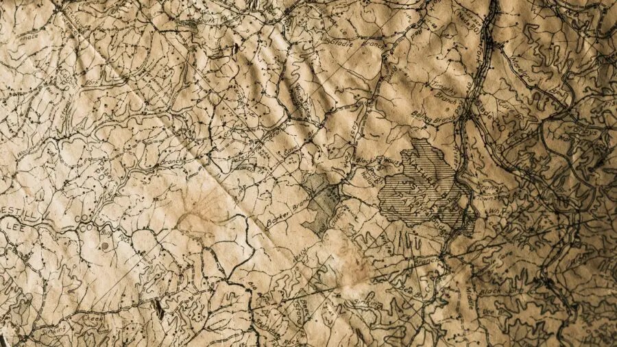
Using historical maps to research your ancestors helps offer a unique and fascinating window into the past. These carefully crafted artefacts, capturing landscapes and territories of bygone eras, hold invaluable clues that can guide us on a captivating expedition of discovery.
In this article, we will embark on a voyage through time, exploring the power of using historical maps to research your ancestors. We will delve into the art of deciphering cartographic secrets, learn where to find these treasured maps, and uncover the hidden stories they tell. Each section will bring forth a different facet of historical map research, ensuring that you gain a comprehensive understanding of their significance and potential.
LOCATING AND ACQUIRING HISTORICAL MAPS: UNVEILING THE CARTOGRAPHIC TREASURES
When it comes to delving into the world of historical maps, the first step is to locate and acquire these invaluable artifacts. Fortunately, the digital age has made it easier than ever before to access a wealth of historical maps from various sources around the globe. Let’s explore some avenues for discovering and obtaining these cartographic treasures.
-
- Online Archives and Libraries: Numerous online archives and libraries house extensive collections of historical maps. The David Rumsey Map Collection (davidrumsey.com) is a notable resource, offering a vast assortment of digitized maps from different periods and regions. The Library of Congress (www.loc.gov) is another excellent repository, featuring a rich collection of maps spanning centuries.
- Historical Societies and Museums: Local historical societies and museums often possess their own collections of historical maps. These institutions can provide access to maps that specifically focus on the region or community of interest. Searching for the websites or contacting the historical societies and museums in your ancestral areas can yield fruitful results.
- Map Collections and Specialized Websites: Various websites and organizations specialize in curating and digitizing historical maps. The website Old Maps Online (oldmapsonline.org) serves as a portal to numerous map collections worldwide, allowing you to search for specific locations and time periods. The National Geographic Maps (www.natgeomaps.com) website offers a wide range of historical maps for exploration and purchase.
- University Libraries and Archives: University libraries and archives often have comprehensive map collections available to researchers. Many institutions have digitized portions of their collections and made them accessible online. Check the websites of universities or contact their library departments to explore their map resources
- Government and Geographic Institutions: National or regional government agencies, as well as geographic institutions, may provide access to historical maps. For example, the National Archives and Records Administration (archives.gov) in the United States offers an extensive collection of maps and records that can be explored online or accessed in person
- Auctions and Antique Map Dealers: Auction houses and antique map dealers can be excellent sources for acquiring original historical maps. Websites like Sotheby’s (sothebys.com) and Christie’s (www.christies.com) regularly host map auctions, allowing collectors and enthusiasts to acquire unique pieces of cartographic history. Additionally, antique map dealers often offer a wide selection of maps for sale, both online and in physical stores.
ANALYZING AND INTERPRETING HISTORICAL MAPS: DECODING THE CARTOGRAPHIC SYMBOLS
Once you have acquired a historical map relevant to your ancestral research, the next step is to delve into the art of analyzing and interpreting the rich array of symbols and features it contains. These symbols hold the key to unlocking the hidden stories and valuable information embedded within the map. Let’s explore some common symbols you may encounter on historical maps and their potential interpretations:
-
- Compass Rose: The compass rose, typically found in the corner of a map, indicates the orientation of the map—north, south, east, and west. Understanding the compass rose allows you to align the map correctly and navigate the depicted areas accurately.
- Legends and Key: Often located in a corner or along the map’s edge, the legend or key provides explanations for the various symbols and markings used on the map. It helps decipher symbols such as rivers, roads, cities, boundaries, and topographic features. Consult the legend to understand the significance of specific symbols.
- Topographic Features: Different contours, hachures, or shading patterns on a historical map represent the terrain and topographic features of the depicted area. Mountains, hills, valleys, and bodies of water can be identified by examining these symbols. For instance, lines close together indicate steep slopes, while lines farther apart suggest gentle terrai
- Settlements and Cities: Symbols representing settlements and cities can vary on different maps. Pay attention to different markers, such as circles, squares, or dots, to denote varying population sizes or levels of significance. Some maps may use different symbols to distinguish between towns, villages, or capital cities
- Transportation Networks: Historical maps often include symbols for roads, trails, railways, and waterways. These symbols provide insights into the transportation networks that connected different regions. Look for dashed or solid lines of varying thickness to identify different types of routes and their importance.
- Political Boundaries: Maps display political boundaries, such as national borders, state or province lines, or county divisions. These boundaries can change over time due to historical events or territorial shifts. Observe different line styles, colors, or shading patterns to discern the delineation of political entities
- Cultural and Historical Sites: Some historical maps may feature symbols or labels representing cultural or historical landmarks, such as churches, forts, archaeological sites, or landmarks of importance. These markers can provide clues about the religious, military, or social aspects of the depicted area
- Cartographer’s Annotations: Occasionally, historical maps may contain handwritten or printed annotations made by the cartographer. These notes can provide additional context or explanations about certain features on the map, adding depth to your interpretation.
TRACING ANCESTRAL MIGRATION PATTERNS: UNVEILING THE FOOTSTEPS OF THE PAST
One of the most captivating aspects of genealogical research is uncovering the migration patterns of our ancestors—the paths they traveled and the places they called home. Historical maps hold a wealth of information that can shed light on these ancestral journeys, allowing us to retrace their footsteps and understand the context of their migrations. In this section, we will explore how historical maps can be invaluable tools for unraveling the migration patterns of our forebearers.
-
- Identifying Significant Locations: Historical maps can help identify significant locations associated with our ancestors. Begin by gathering information from family records, oral histories, or existing genealogical research to pinpoint the places where your ancestors lived or migrated from. Armed with this knowledge, carefully examine the maps of those regions and identify key towns, cities, landmarks, or geographical features that are relevant to your ancestral research.
- Tracing Routes and Transportation Networks: Historical maps often depict roads, trails, waterways, and railways, which were crucial transportation routes in the past. Follow these routes on the map and trace their connections to the significant locations associated with your ancestors. This can provide insights into the paths they may have taken during their migrations and the modes of transportation available to them.
- Comparing Maps from Different Time Periods: Migration patterns can change over time due to various factors such as economic opportunities, political events, or environmental conditions. By comparing historical maps from different time periods, you can observe shifts in population centers, the emergence of new settlements, or the impact of infrastructure development. This analysis can provide a broader understanding of how your ancestors’ migration patterns evolved over generations
- Exploring Settled Areas and Frontier Expansion: Historical maps can reveal the progression of settlement patterns and frontier expansion. Look for changes in the density of population centers, the establishment of new towns or colonies, and the gradual exploration of previously uninhabited or sparsely populated areas. These shifts can indicate the areas where your ancestors may have sought new opportunities or participated in westward expansion
- Examining County and State Boundaries: Political and administrative divisions, such as county or state boundaries, can play a significant role in tracing migration patterns. Analyze historical maps to identify changes in these boundaries over time, as they can influence the movement of populations and the formation of new settlements. Understanding these geopolitical changes can offer valuable insights into the context of your ancestors’ migrations.
- Connecting Ancestral Movements and Settlements: By combining the information gathered from historical maps with your genealogical research, you can start connecting the dots and mapping out the migration routes and settled areas of your ancestors. Visualize their movements on the maps, create annotations or overlays to mark their significant locations, and document the timeline of their migrations. This holistic approach can bring their journeys to life and deepen your understanding of their experiences.
LAND OWNERSHIP AND PROPERTY RESEARCH: UNVEILING ANCESTRAL ESTATES
Historical maps not only offer a glimpse into the geographical landscape of the past but also serve as invaluable resources for investigating land ownership and property records. By harnessing the power of these maps, we can delve into the realms of our ancestors’ landholdings, gaining insights into their socio-economic status and the legacies they left behind. In this section, we will explore how historical maps can be utilized to uncover the hidden stories of ancestral estates.
-
- Tracing Land Parcels and Boundaries: Historical maps often include detailed information about land parcels, boundaries, and ownership divisions. By examining these maps, you can trace the specific plots of land associated with your ancestors. Look for labeled or numbered parcels, survey markers, or property lines that indicate individual landholdings. This can provide a foundation for further research into deeds, property records, and other relevant documents.
- Comparing Maps and Atlases: Comparing different maps and atlases from various time periods can reveal the evolution of land ownership over time. By observing changes in land parcel sizes, shape, or boundaries, you can uncover details about land transactions, inheritance patterns, or divisions among family members. This analysis can shed light on the socio-economic dynamics of your ancestors and their connections to the land.
- Examining Ownership Labels and Annotations: Historical maps may contain ownership labels or annotations indicating the names of landowners. These labels can be invaluable in identifying specific individuals or families associated with particular parcels of land. By cross-referencing these names with genealogical records, such as wills, land deeds, or tax assessments, you can further solidify the link between your ancestors and their landholdings.
- Overlaying Historical Maps with Modern Maps: Overlaying historical maps with modern maps or satellite imagery can provide a fascinating perspective on changes in the landscape. This technique allows you to superimpose the historical boundaries and landmarks onto current geographical features, making it easier to locate and understand ancestral properties. Additionally, modern mapping technologies can help identify present-day names of places that correspond to historical names on the maps.
- Exploring Socio-Economic Context: Historical maps can provide insights into the socio-economic context of ancestral landholdings. By examining the proximity of ancestral properties to natural resources, trade routes, or urban centers, you can gain a better understanding of the economic opportunities available to your ancestors. This information can shed light on their livelihoods, social standing, and interactions with the local community.
EXPLORING BOUNDARIES AND HISTORICAL CONTEXT: UNVEILING ANCESTRAL INTERACTIONS AND GEOPOLITICAL CHANGES
Historical maps not only depict the physical features of the past but also serve as windows into the dynamic nature of boundaries, political divisions, and geopolitical changes. Understanding these aspects and delving into the historical context they represent can provide valuable insights into our ancestors’ lives, interactions, and the influences of different jurisdictions. In this section, we will explore the significance of comprehending historical boundaries and political divisions as we embark on the journey of researching our ancestors.
-
- Tracing Political and Administrative Divisions: Historical maps often delineate political and administrative divisions such as national borders, state or provincial lines, and county boundaries. By studying these divisions, you can gain a deeper understanding of the jurisdictions under which your ancestors lived and moved. Tracking changes in these boundaries over time can unveil the impact of historical events, territorial shifts, and political decisions on their lives.
- Investigating Jurisdictional Changes: Geopolitical changes, such as the formation or dissolution of empires, the creation of new nations, or the redrawing of boundaries, can greatly impact our ancestral research. Historical maps allow us to visualize these changes and their implications for our ancestors. By understanding the historical context surrounding these shifts, we can better interpret the records, documents, and stories from different jurisdictions that our ancestors encountered.
- Analyzing Borderlands and Cultural Exchange: Borders and boundaries have historically been places of cultural exchange, trade, and interaction. Exploring historical maps can shed light on the borderlands where our ancestors may have resided, connecting different regions or even crossing political boundaries. These borderlands can hold valuable insights into cultural blending, migration patterns, and ancestral connections that spanned across geopolitical divisions.
- Contextualizing Socio-Political Factors: Historical maps provide a broader understanding of the socio-political factors that influenced our ancestors’ lives. By examining the proximity of their residences to cities, trading hubs, or strategic locations, you can gauge the influence of economic opportunities, social networks, and political dynamics on their daily existence. This context can enrich our research and offer a deeper understanding of their societal roles and experiences.
- Researching Records and Archives: The knowledge of historical boundaries and geopolitical changes can guide us in navigating the vast landscape of records and archives. Understanding which jurisdictions held records at specific times can help identify relevant resources for our ancestral research. By aligning our search with the historical context, we can locate and access records that illuminate the lives of our ancestors within the relevant administrative and governmental frameworks.
UTILIZING DIGITAL MAPPING TOOLS: UNLEASHING THE POWER OF MODERN TECHNOLOGY
As we conclude our exploration of using historical maps to research our ancestors, it’s essential to acknowledge the remarkable advancements in digital mapping tools and technologies. In the digital age, platforms like Geographic Information Systems (GIS) have revolutionized the way we interact with maps and visualize ancestral connections. In this final section, we will delve into the advantages of utilizing modern digital mapping tools and how they enhance our ability to uncover and share the stories of our ancestors.
-
- Interactive and Customizable Maps: Digital mapping tools offer the flexibility to create interactive and customizable maps tailored to our specific research needs. With a few clicks, we can overlay historical maps onto modern ones, add markers, annotate locations, and even include multimedia elements. This interactivity enables us to explore ancestral connections, trace migration routes, and visualize the historical context in a more engaging and dynamic manner.
- Spatial Analysis and Data Integration: Digital mapping platforms provide robust spatial analysis capabilities, allowing us to integrate diverse datasets and extract valuable insights. By combining historical records, census data, land surveys, and other relevant information, we can uncover patterns, relationships, and correlations that might have remained hidden otherwise. This integration of data empowers us to enrich our understanding of our ancestors’ lives and the context in which they lived.
- Remote Collaboration and Sharing: Modern digital mapping tools facilitate remote collaboration and sharing of research findings. Whether it’s collaborating with fellow researchers, connecting with distant relatives, or sharing discoveries with a wider audience, these platforms enable seamless sharing and access to interactive maps. This promotes collaboration, fosters a sense of community, and accelerates our collective understanding of our shared ancestral heritage.
- Spatial-Temporal Visualization: Digital mapping tools excel at visualizing spatial-temporal relationships, allowing us to explore the dynamic aspects of our ancestors’ lives. Through animations, timelines, and layered maps, we can witness the evolution of boundaries, track migrations over generations, and uncover the ebb and flow of ancestral communities. This spatial-temporal visualization brings history to life, offering a profound appreciation for the journeys and experiences of our forebearers.
- Access to Vast Data Sources: Digital mapping tools provide access to an extensive range of data sources, including historical maps, aerial imagery, satellite data, and geospatial databases. These resources enable us to tap into a wealth of information and enhance our research with contextual data. By harnessing the power of these data sources, we can gain deeper insights into our ancestors’ lives and connect their stories to the broader historical narrative.
Incorporating modern digital mapping tools into our ancestral research allows us to bridge the gap between the past and present, enabling us to navigate, analyze, and share our findings in exciting and impactful ways. As we embrace these technological advancements, we expand our ability to connect with our ancestors, preserve their legacies, and pass down their stories to future generations. So, let us embrace the possibilities that digital mapping tools offer, as we continue to unravel the rich tapestry of our ancestral heritage.


